Start here
The lanes
Wood, stream and cafes
Compare the cornersGuides
Language
Currency
See availabilitystarting at $75 · free cancellationLocate your stop
Fast answer
Mae Kampong village in Chiang Mai is a small mountain community of tea and coffee growers that runs its tourism through a village cooperative.
The village in brief
Map of 31 stops
Select a route, then press a pin or stop to read its note and open Google Maps.
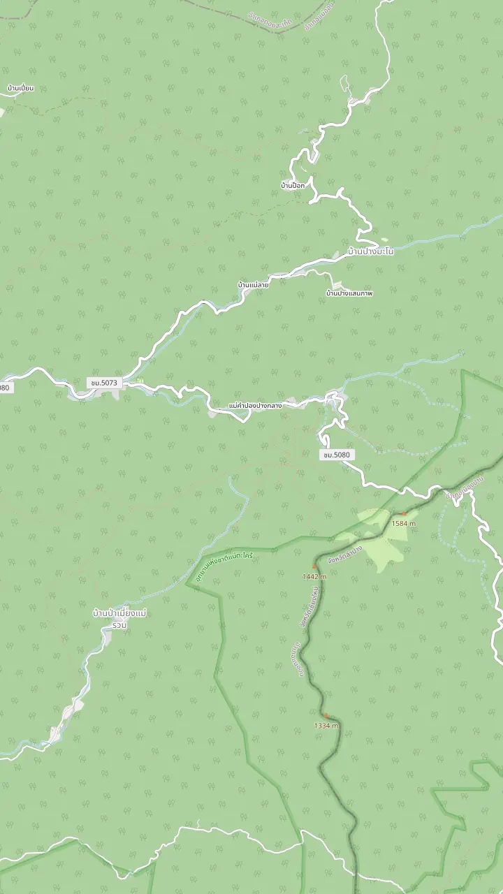
The lanes of Mae Kampong sit about 1,300 m above sea level.
Google MapsA coffee house on the village lane, named in the minivan listing.
Google MapsA village temple, named as a stop by the private minivan listing.
Google MapsA viewpoint cafe above the valley, named as a stop by the Giant Cafe day trip.
Google MapsA multi-level waterfall a short walk from the village.
Google MapsA viewpoint that one private day names as its panoramic stop.
Google MapsThe Teen Tok Royal Project Development Center, a stop on the minivan listing.
Google Maps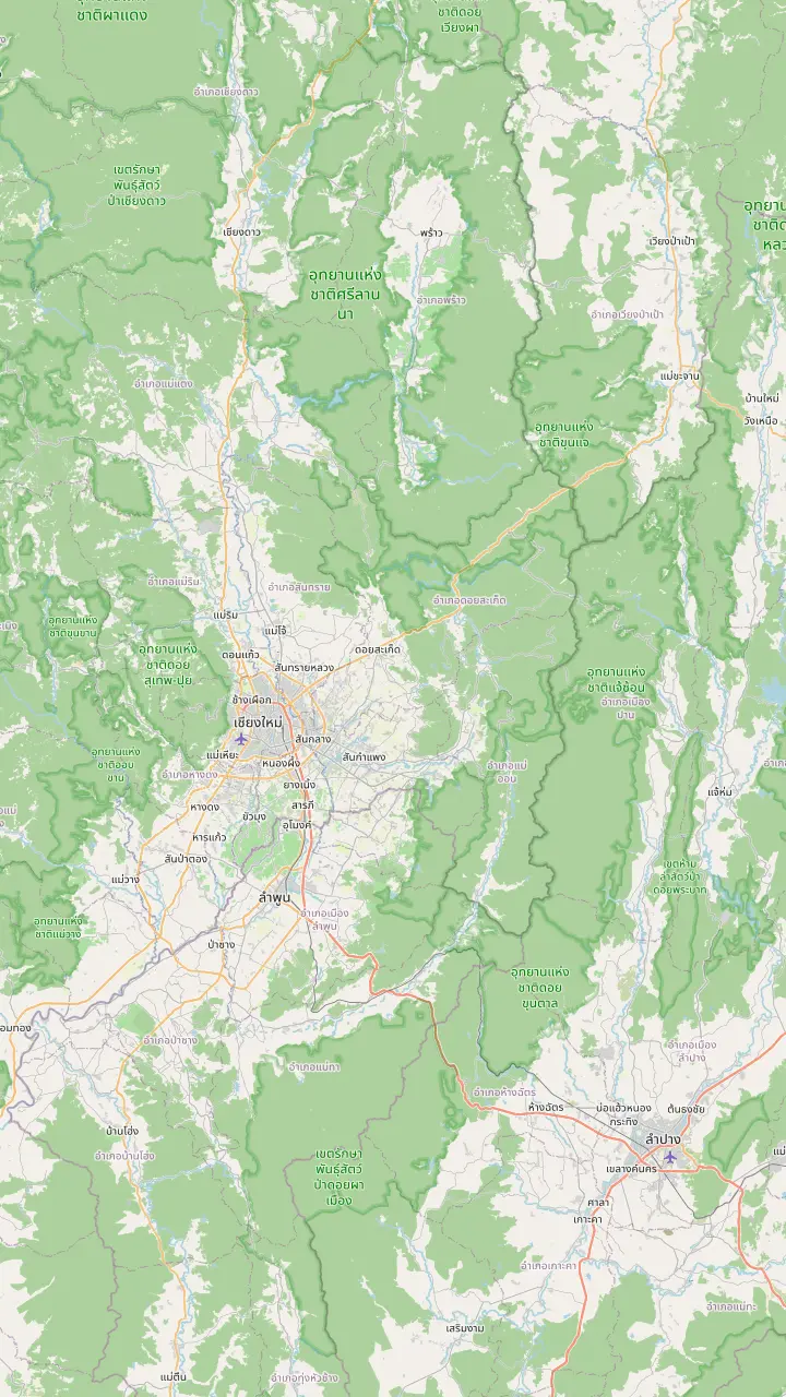
The old-city gate, used here only as the Chiang Mai reference point.
Google MapsChiang Mai International Airport, south-west of the old city.
Google MapsThe city's Arcade bus terminal, north-east of the old city.
Google MapsThe umbrella-making centre of Bo Sang village, in San Kamphaeng district.
Google MapsThe San Kamphaeng hot springs lie in Mae On District.
Google MapsThe lanes of Mae Kampong sit about 1,300 m above sea level.
Google Maps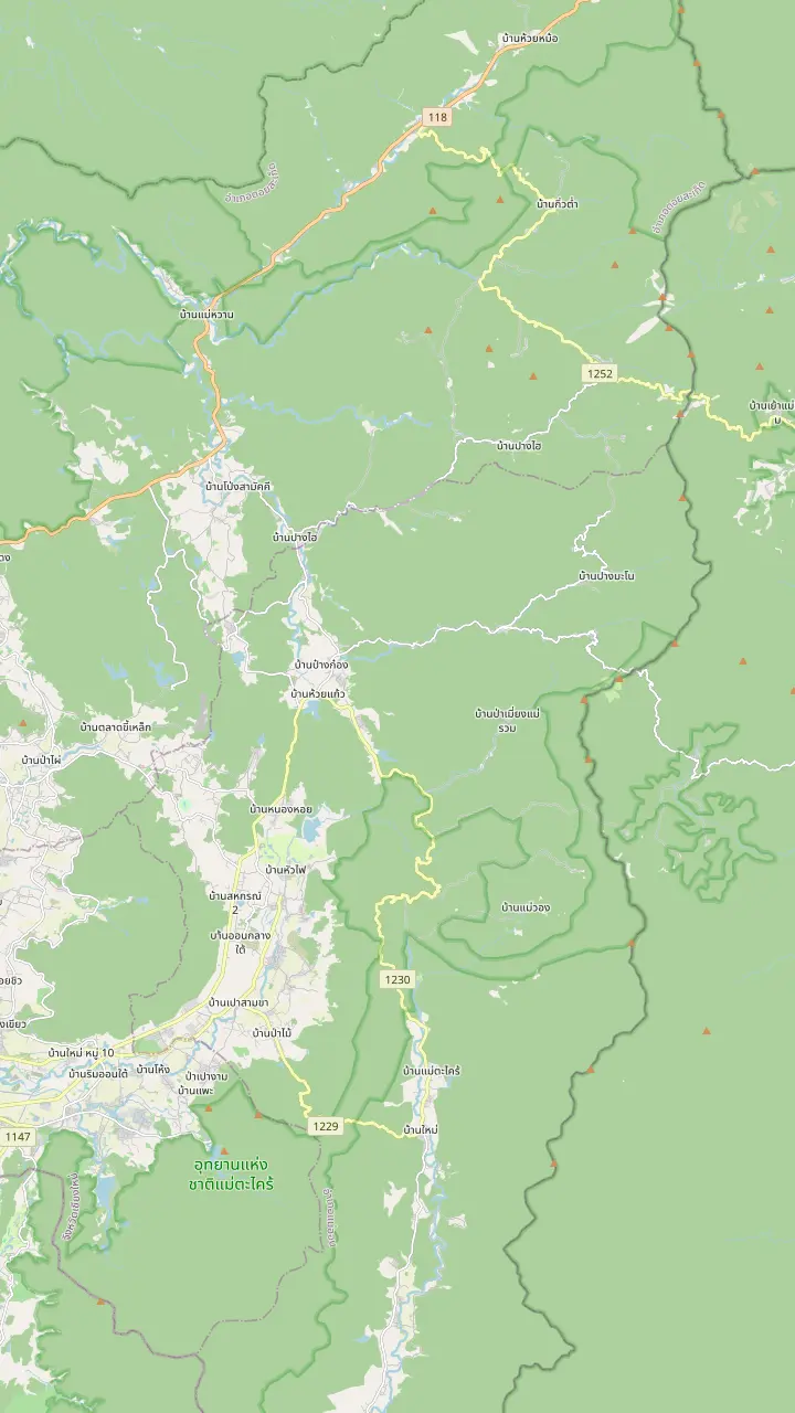
The lanes of Mae Kampong sit about 1,300 m above sea level.
Google MapsA multi-level waterfall a short walk from the village.
Google MapsThe Teen Tok Royal Project Development Center, a stop on the minivan listing.
Google MapsThe treetop cafe with a wooden skywalk, reached by local truck on the private day that adds it.
Google MapsA zipline and trekking park in the forest north of the village.
Google MapsA set of nature trails north of the village.
Google MapsA limestone cave with stairs to the entrance, where wild monkeys may be seen.
Google MapsThe San Kamphaeng hot springs lie in Mae On District.
Google Maps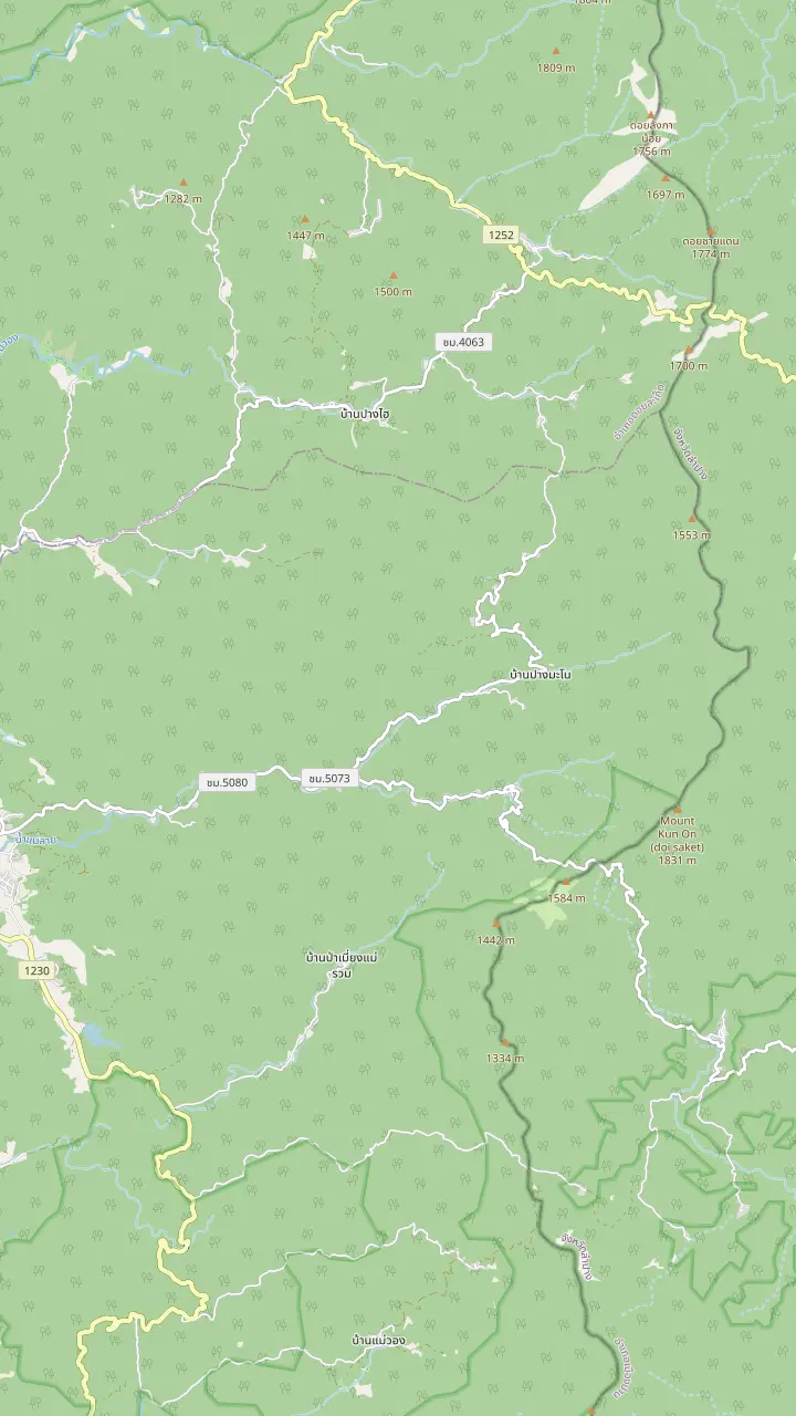
The lanes of Mae Kampong sit about 1,300 m above sea level.
Google MapsA viewpoint that one private day names as its panoramic stop.
Google MapsA multi-level waterfall a short walk from the village.
Google MapsThe Teen Tok Royal Project Development Center, a stop on the minivan listing.
Google MapsA guest house on the village lane.
Google MapsA guest house on the village lane.
Google MapsA hotel north-west of the village, towards the road down to the plain.
Google MapsA camping resort west of the village, close to the Royal Project centre.
Google MapsA lodge in the valley west of the village, near the Royal Project centre.
Google MapsA homestay north of the village, near the Giant Chiang Mai cafe.
Google MapsMap data from © OpenStreetMap contributors
A map-led guide to the village east of Chiang Mai: the name, the people, the tea and coffee, the hydro power, the cooperative and the lanes you walk.
Editorial team, maekampongtour.top · Updated November 12, 2026 · Read in 7 min
Overview
Mae Kampong is a small settlement in the hills east of Chiang Mai, at the end of a winding road that climbs well above the plain. A tour listing for the village gives its elevation as 1,300 meters, and the FAO case study that describes the community uses nearly the same figure, 1300 m above sea-level, placing it in Tumbon Hauy Kaew of Mae Orn District in Chiang Mai Province.6 The spelling differs between papers, but the place is the same: a clearing among forested slopes, reached from the city by a drive of 1 hour.
The name carries the landscape inside it. The FAO paper glosses mae as a river or stream, and the villagers name the place Baan Mae Kampong after it.1 It also notes reddish yellow flowers on the bank at the village edge, known locally as the kampong flower.7 A private day listing for the village repeats the idea in its own way, describing a hidden village by a creek and yellow flowers that gave it the name. You can read the name as a map note: water first, then a flower on its bank.
So what is Mae Kampong village today? It is a working mountain community that doubles as an ecotourism village. Farmers still grow tea and coffee in the forest, while visitors come for the cool air, the stream, the waterfall, the viewpoints and a way of life that has changed slowly. Tourism profits go into a village co-operative that sustains local projects.3 Treat it as someone's neighborhood that happens to welcome guests, and the rest of this guide will make more sense.
On the map
| Place | What it is | Position on the map |
|---|---|---|
| Village lanes | Old wooden shophouses selling Lanna food.21 | The centre, beside the stream |
| Waterfall | Cascades down 7 rocky steps.22 | A short walk from the lanes |
| Teen Tok project | Arabica coffee and tea farming.23 | West of the village |
| Kew Fin viewpoint | Unobstructed views of the province.24 | South-east of the lanes |
| Ing Dao cafe | A grandstand view over the village.25 | Closer to the village |
| Giant Chiangmai | A treehouse cafe over the rainforest.26 | North of the village |
Descriptions as the Mekong Tourism Coordinating Office gives them; positions read off the pins on the map above.
The FAO case study traces the settlers to tea. Tea gatherers from nearby Doi Sa Ked District, who earned their main income from jungle tea,8 later moved over and settled here.9 At the time of the study the village had 130 households and a total population of 415 persons on 6 km2.14 Those figures come from an older case study, so read them as a snapshot of the community's scale, not as today's census.
Most of the land is forest, not houses. Houses and gardens take up 65 rais and the rest is evergreen forest,15 split evenly between a dense stand of 1842.5 rais and a sparse stand of equal size, where jungle tea and coffee give the villagers a regular living.16,2 The community forest lies inside the Mae Orn National Forest Reserve.17 The chart below turns those numbers into bars, and it shows how small the built-up part of the village is next to the trees.
The forest also supplies everyday goods. In the tea forest the young leaves become tea, and the older leaves are fermented into miang, a chewing snack with roots in Lanna times.18 The paper also counts edible mushrooms, leaves and cinnamon among the forest products on hand.19 TAT describes a Lampang community that makes miang by boiling and fermenting old Assam tea leaves, which gives a sense of the process even though that village lies elsewhere.20
Mae Kampong village history, in its modern chapter, starts with coffee. In the 1980s the village began growing coffee for the Royal Project,10 part of a national effort that TAT says the late King Bhumibol started in 1969 to tackle poverty and opium growing in the northern Golden Triangle.29 The Royal Projects promoted alternative crops and reforestation, and that gave farmers a new source of income.30 A mountain village with sparse forest and cool weather fitted the plan well.
Water came next. In 1983 the King paid a visit to the area and suggested that the village generate its own hydroelectric power from the nearby stream and falls.11,4 At the time of the FAO study the sale of electricity to villages further down the mountain was the village's main source of income.31 That history turns the stream and the waterfall into working infrastructure as well as scenery, so stay on the marked paths and leave any pipes and channels alone.
Tourism followed, with the village head encouraging a long-stay programme in December 2000.12 Later the village headman proposed Mae Kampong as an eco-tourism village, taking advantage of its natural surroundings and mountain location, after the village had joined the One Tambon One Product scheme.32 That order of events, coffee first, then power, then guests, is the history worth carrying with you into the lanes.
Choose your angle
Say what you came for and see which corner of Mae Kampong answers it.
If I want to understand how the village earns a living
Teen Tok project and the cooperative
The Royal Project site farms arabica coffee and tea,23 and tourism money goes to the cooperative.3
If I want to walk without a plan
The village lanes
The main road is lined with old wooden shophouses,21 and everything else is a short walk away.
If I want a waterfall photo stop
The waterfall
It cascades down 7 rocky steps and is reached by a short hike.27,22
If I want a big view and a coffee
A hill cafe
Kew Fin, the Giant cafe and the Ing Dao cafe are all named by the MTCO as viewpoints.24,26,25
If I want to see how the village sells its tea
Ask about miang
Older tea leaves are fermented for miang, a snack popular since ancient Lanna.18
Corners of the village
Start here
Wood, stream and cafes
Compare the corners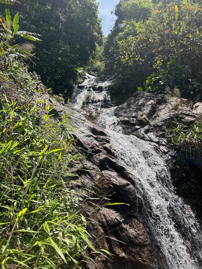
Cool off
A short forest walk
Compare the corners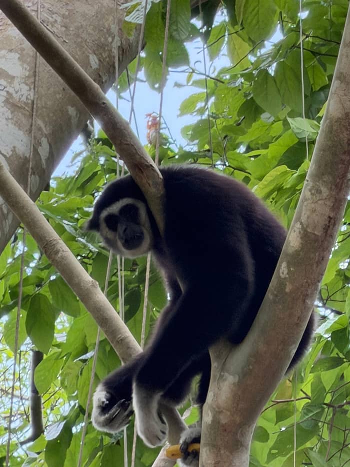
Add a view
Cafes above the valley
Mae Kampong's tourism is organized by its residents. Profits from tourism go into a co-operative, which sustains local projects and helps preserve the community.3 The MTCO counts over 30 households taking part in the effort and adding their revenue to the cooperative,41 and it lists tree planting, a buffer line to slow forest fires, and anti-illegal logging and anti-orchid smuggling initiatives among the things the cooperative funds.40 In practice that means part of what the participating households earn from visitors goes into a shared pot.
Outside observers have checked the claim. Researchers who looked at Mae Kampong in 2016 reported that tourism had lifted local livelihoods enormously.13 In 2020 TAT's inaugural rural tourism awards named Ban Mae Kampong Ecotourism Village first runner-up for Best Homestay.5 The panel that judged those awards voted on a formula of 70% committee members and 30% media representatives after a strict selection.42
For you as a visitor the practical rule is simple. Spend in the village, not only at the car park, and favor small businesses on the lanes. The FAO study lists the community's friendliness, the cool air and the simple life of the villagers as what attracts visitors,28 and it adds that the community still maintains its original character.43 That character is what the cooperative is protecting, and visitors help most by moving through the lanes quietly.
Over the decades
Before the village
Villagers from Doi Sa Ked came to collect jungle tea, and later they settled in the hills.8,9
Coffee years
The village started growing coffee for the Royal Project during the 1980s.10
A royal visit
In 1983 the King visited and suggested hydroelectricity from the stream and waterfall.11,4
Turn of the century
The village head encouraged a long-stay programme in December 2000.12
A study
A 2016 study found tourism had boosted local livelihoods.13
Recognition
The village placed as the Best Homestay runner-up in 2020.5
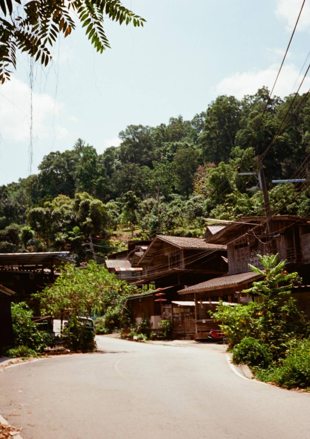
Along the main road, old wooden shophouses sell rustic Lanna food,21 and that street is the heart of the village. A stream runs through the settlement, and the map above places the village centre on it, with the coffee house Ted Du on the western lane and a village temple a short walk east. The private minivan listing names temples among its stops, Wat Khantha Phueksa among them. Wander slowly and read the signs: the lane is short, but it holds houses, shops and cafes side by side.
The viewpoints sit a little outside. Sweeping outlooks are on the MTCO's list: Kew Fin Viewpoint,24 the Giant Chiangmai treehouse cafe26 and the Ing Dao cafe nearer the village.25 On the map the Kew Fin viewpoint lies south-east of the lanes and the Giant cafe well to the north, so plan them as separate short drives, not as a stroll. Fit them into the middle of the morning, when the air has cleared, and treat a clear sky as a bigger factor than the choice of cafe.
More places round out a visit. The waterfall, a short hike from the lanes, falls in 7 rocky steps,22 and the Teen Tok Royal Project, west of the village on the map, backs diversified farming led by arabica coffee and tea.23 A separate page on this site covers the waterfall, and another the cafes. Use this section as the overview: start in the lanes, add the waterfall for the walk, then choose a hill stop for the view.
Video
Vanessa Huang on YouTube · The video waits until you tap play to load.
The cool air throughout the year, the simple life of the villagers and their friendliness attract visitors
Before you walk the lanes
A village temple deserves the same manners as a famous one. TAT's etiquette guide asks men to wear sleeves with trousers or shorts that reach the knees,35 and women to wear a sleeved top with a skirt below the knee.36 Visitors go into a temple barefoot, and racks outside every temple hold the shoes.37 Carry a light cover-up in your day bag, because the mountain air and the temple rules call for sleeves.
Behavior inside matters as much as clothing. Put your phone on silent inside, per TAT,38 and never aim your feet at a Buddha image.44 Getting in someone's way for a photo counts as rude, particularly while they pray or make a donation.39 The same courtesy applies on the lanes: ask before you photograph a person at work, and never step into a garden or a drying yard to get a better angle.
Finally, keep your footprint small. Stay on the paths, carry your litter out and speak softly in the early evening, when the lanes are quietest. The village cooperative funds tree planting and a fire buffer line,40 so a cigarette dropped on a dry slope is the opposite of what the community is working toward. A visitor who treats the lanes as a neighborhood will be treated as a guest, and that is the entire etiquette in a sentence.
FAQ
Sources
Related reading
Planning the day to Mae Kampong? Ask a real person here.